Drone Surveys
How can Drone Surveys help my project?
Survey Solutions is a UK drone survey company delivering accurate, high-quality aerial survey data for land, building and infrastructure projects. Our drone surveys provide a fast, safe and efficient way to capture detailed information across sites of all sizes, from domestic roof inspections and holiday parks to quarries, landfills, development sites and large national survey programmes.
Using the latest drone surveying technology, we help clients collect reliable data in locations that may be difficult, time-consuming or unsafe to access using traditional methods alone. For many projects, drone surveying offers a practical way to improve site visibility, reduce time on site and support better decision-making from the earliest planning stages through to delivery and asset management.
Faster, safer and more accessible survey data
One of the biggest advantages of drone surveys is the ability to gather comprehensive site information quickly without compromising on quality. Drones can be used to capture aerial imagery and measurement data over large areas, complex terrain and hard-to-reach structures, helping to reduce disruption and improve safety for survey teams and site personnel.
Whether you need data for planning, design, inspection, maintenance or ongoing project monitoring, our team will recommend the most suitable drone survey approach for your requirements.
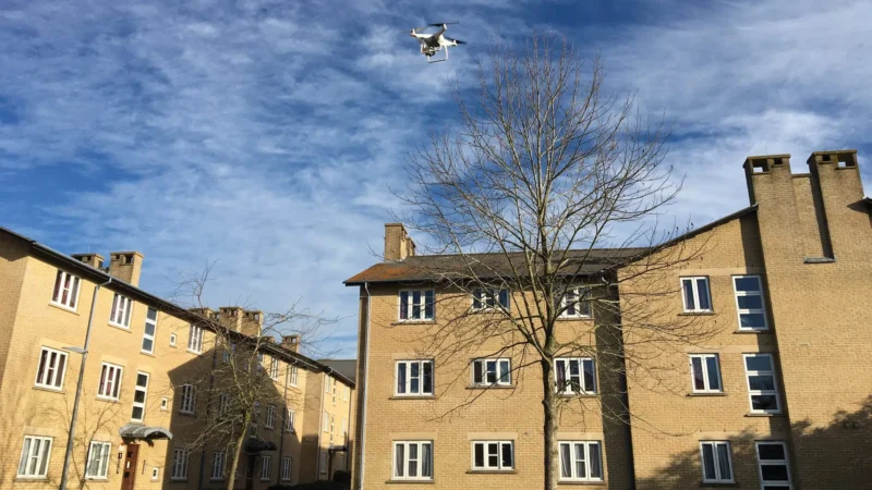
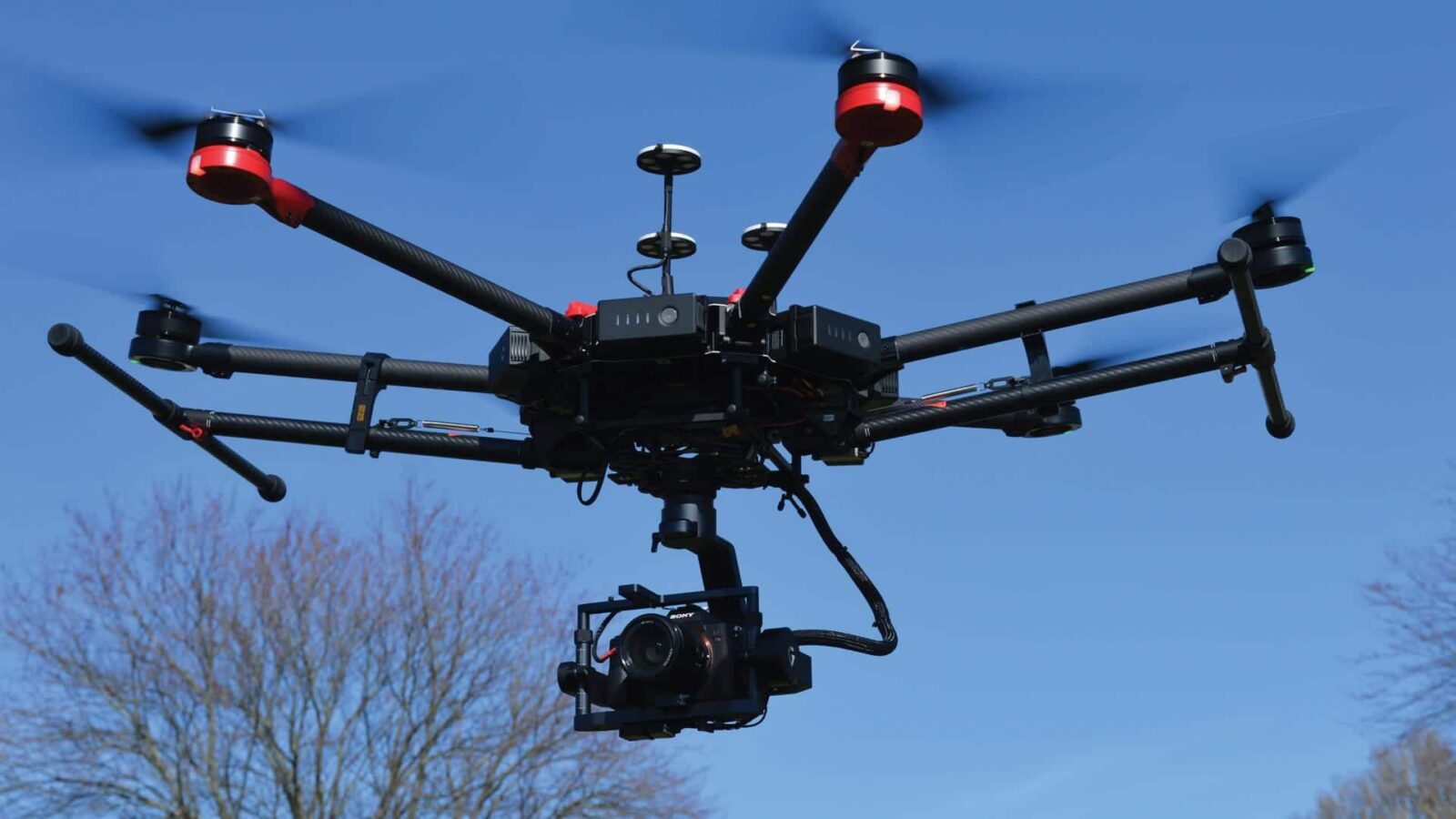
In-house Drone Pilots across the UK
We have our own in-house team of qualified drone pilots available nationwide, allowing us to mobilise quickly and deliver drone surveying services across the UK. For clients looking for a dependable drone survey company with national coverage, this means consistent standards, responsive scheduling and a single trusted surveying partner.
Our drone team is equipped with the latest survey technology and has completed both one-off commissions and multi-site programmes throughout the country. From individual property inspections to complex portfolio and infrastructure projects, we provide the same focus on quality, safety and service at every stage.
All of our drone pilots operate in full compliance with Civil Aviation Authority requirements for Remotely Piloted Aircraft Systems, giving clients confidence that surveys are carried out safely, professionally and in line with current regulations.
Drone Building Surveys and Drone Land Surveys
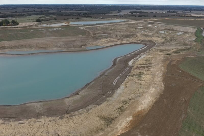
Our drone capability supports both drone building surveys and land-based survey projects. For buildings, drones can help inspect roofs, elevations and other difficult-to-access areas, capturing clear visual information while reducing the need for more intrusive access methods. For land projects, drones can efficiently collect aerial data across larger sites, making them especially valuable for topographical surveys, development land, infrastructure corridors and environmental or industrial settings.
Because drone surveys sit alongside our wider surveying expertise, we can also advise on how aerial data can be integrated with other survey deliverables where required. This gives clients a more complete understanding of their site, asset or property from a single survey partner.
Why choose Survey Solutions for Drone Surveys?
At Survey Solutions, we combine experienced surveyors, qualified drone pilots and advanced technology to deliver dependable results for a wide variety of projects. Our clients choose us for drone surveys because we offer:
- nationwide coverage across the UK
- an in-house team of qualified drone pilots
- CAA-compliant operations
- fast mobilisation and efficient data capture
- a broad range of survey outputs tailored to each project
- support for both land and building applications
If you are searching for a drone survey near me, our UK-wide coverage means we can respond quickly and deliver a professional service wherever your site is located.
Drone Survey Services
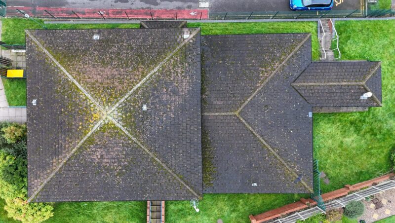
Drones for Buildings
Survey Solutions uses drones for buildings by using fly over video for measured building data available in 2D and 3D formats.
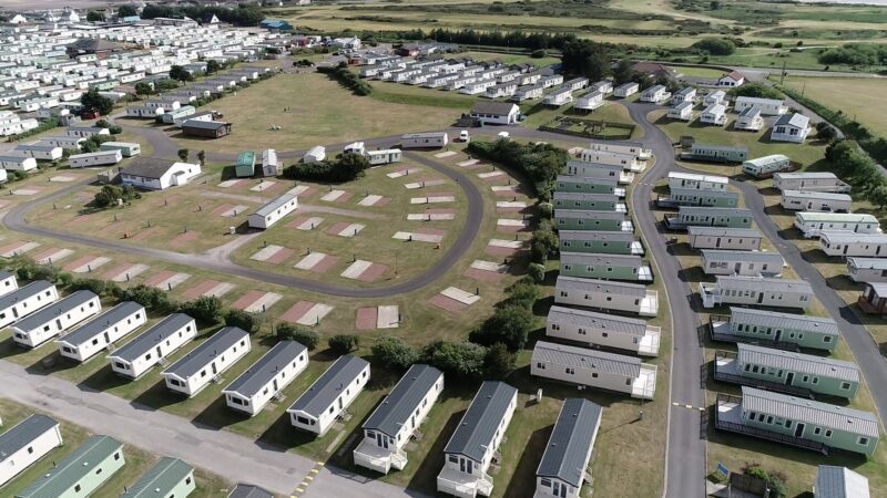
View service detailsDrones for Land
Drones for land surveying are a cost-effective solution for projects such as quarries, landfills, or large-scale development.
View service details
Drone Survey FAQ’s
Drone surveys capture high-quality aerial data quickly, ideal for large or hard-to-access sites, roof inspections, quarries, landfills and multi-site programmes.
Typical outputs include 2D and 3D site plans, point clouds, ortho-rectified photography and video flyovers (chosen to match your brief).
Yes, Survey Solutions has an in-house team of qualified drone pilots and operates in line with Civil Aviation Authority regulations.
Accuracy depends on the project brief and control strategy. For survey-grade outputs, drone capture is typically supported with suitable ground control and verification.
Yes, drone capture can support measured building work, especially where access is limited (for example roofs or difficult elevations).