Underground Surveying

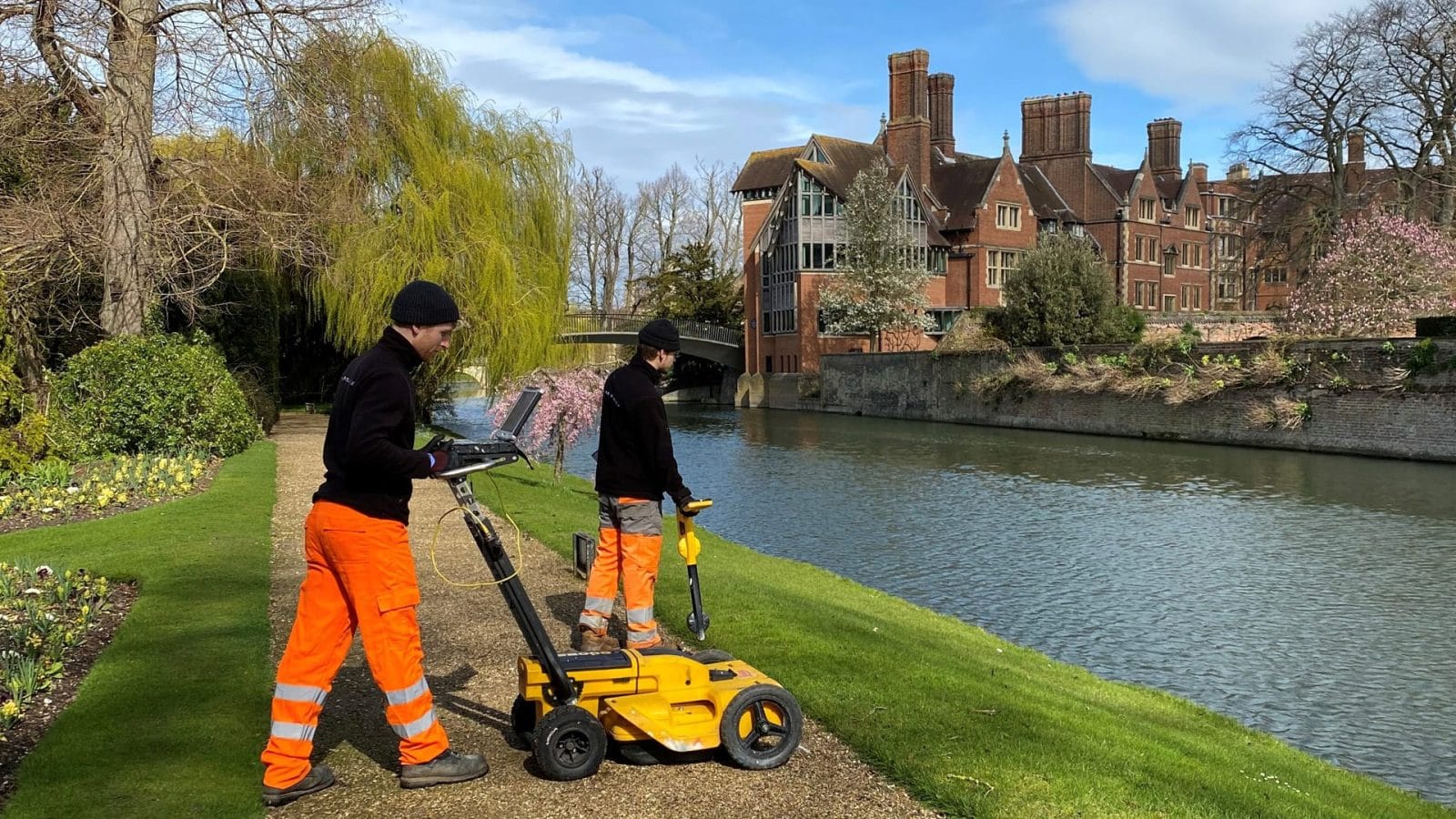
Our specialist Underground Utilities team harnesses the latest survey technology, including dual-frequency ground penetrating radar (GPR), to locate and trace services below ground, including sewers, gas mains, heating and water, lighting cables, BT telephone lines, other communication cables and traffic signalling cables.
In addition to locating utilities, our underground surveys provide detailed data on below ground conditions ahead of any site excavations, drilling, piling or borehole clearance. Using GPR and electromagnetic equipment, we can identify and position underground features such as voids, steelwork, shafts and graves which could impact on future construction activity.
Where remote visual inspections are required, we carry out CCTV surveys with robotic cameras providing high definition visual imagery inside drains, pipes, voids and areas of restricted access. Our surveyors can view the camera images in real-time using specialist on-site software and then provide full digital imagery, supported by a detailed technical report.
Any cracks, root ingress, damage and blockage identified in a drainage survey can be cleared with our high pressure jetting service.
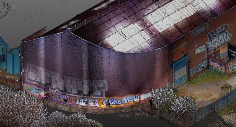
A recent addition to our range of underground surveys is concrete and rebar scanning, where our team uses GPR technology to locate and confirm the layout of structural reinforcement within a building or structure, with data presented as high resolution 3D imagery.
Underground Surveying Services
Asset Tagging
Asset tagging is a recent introduction to our underground surveying services, allowing for permanent identification of underground assets.
View service detailsCCTV Drainage Survey
Uncover potential blocks in your project with our in depth CCTV Drainage Survey, with a full visual inspection and detailed report.
View service detailsGPR Concrete and Rebar Scanning
Book a non-invasive GPR Survey to assess buildings, RAAC planks and concrete beams. Suitable across a broad range of projects and sectors.
View service detailsGround Penetrating Radar (GPR) Survey
A GPR survey provides data for a range of projects such as roadwork investigations, detecting sinkholes and measuring bedrock depth.
View service detailsUnderground and Site Investigations
Using technology such as ground-penetrating radar (GPR), our underground and site investigations identify underground geological features.
View service detailsUtilities Survey
Our PAS 128 utilities survey can locate all mains services including electricity, sewers, gas, water mains, fibre optics, and heating.
View service details
Underground Surveying FAQ’s
An underground utilities survey locates and maps services below ground (e.g., sewers, gas, water, power and communications) to reduce excavation risk and support safe design.
Yes, our utilities surveying includes PAS 128 surveys to help clients plan safely and manage below-ground risk.
We use methods including dual-frequency GPR and electromagnetic equipment to locate utilities and identify features like voids, steelwork, shafts or other buried obstructions.
Yes, where remote inspection is needed we can carry out CCTV drainage surveys using robotic cameras, supplying imagery and a technical report.
Where blockages or issues are identified, clearance can be supported with high-pressure jetting.
Ideally before excavations, drilling, piling or borehole clearance. Early surveying helps avoid programme disruption and reduces on-site safety risk.