Land and Utility Surveyors in Norwich
Survey Solutions’ Norwich office supports projects across Norwich, Norfolk, Cambridgeshire, Lincolnshire and the wider East of England. Our local team provides accurate land surveys, measured building surveys, underground utility surveys, drone surveys, monitoring and site engineering support for residential, commercial, heritage, infrastructure, agricultural, education and public-sector schemes. We help project teams obtain reliable survey data before design, planning, construction or refurbishment work begins.
Survey services from our Norwich office
Our Norwich office provides a full range of survey services for projects across Norfolk and neighbouring counties. These include topographical surveys, measured building surveys, underground utility surveys, UAV/drone surveys, laser scanning, monitoring and site engineering. Each service can be tailored to the project scope, site conditions and required deliverables, helping clients obtain accurate information that supports practical decision-making.
Topographical surveys for Norfolk and East of England sites
Topographical surveys record accurate information about site levels, boundaries, drainage, access, buildings, vegetation, hardstanding and surrounding features. Our Norwich surveyors can support urban, rural, coastal, agricultural, residential, infrastructure and public-sector sites across Norfolk, Cambridgeshire and Lincolnshire. This information is essential for planning, design coordination, engineering, tendering and construction preparation.
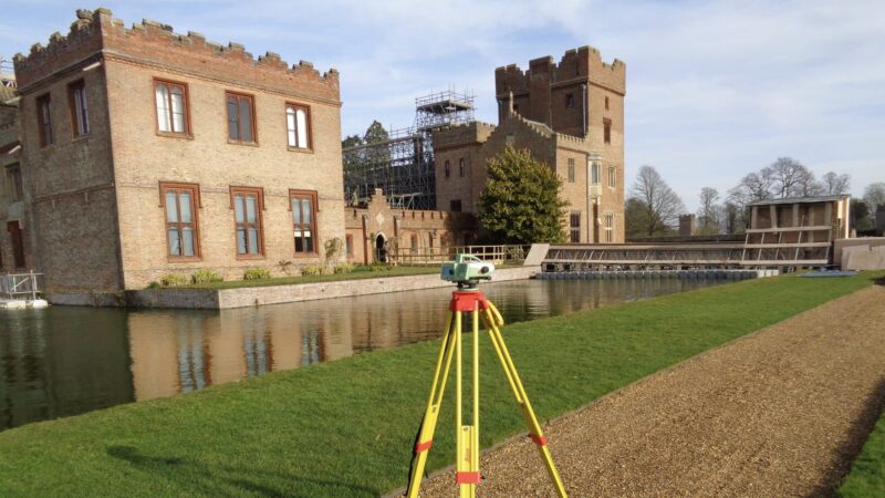
Measured building surveys for heritage, commercial and public-sector assets
The East of England includes a wide range of heritage buildings, public-sector assets, commercial properties, schools, residential buildings and rural estates. Our measured building surveys can provide floor plans, elevations, sections, roof plans, point-cloud data and 3D outputs to support refurbishment, conservation, redevelopment, extension, fit-out or asset management. Accurate measured information helps design teams work with confidence where existing records are incomplete or outdated.
Underground utility surveys for development and infrastructure projects
Buried services can affect design, excavation, drainage, utilities and construction activity. Our Norwich office can provide underground utility surveys to help identify and map below-ground services before works begin. Where required, scopes can be aligned with PAS 128 to provide clearer methodology, confidence levels and deliverable requirements for project teams.
Drone, monitoring and site engineering support
Our Norwich team can provide UAV/drone surveys, monitoring and site engineering support where projects require aerial data, repeat measurements or construction-stage survey input. Drone surveys are useful for rural, coastal, agricultural or hard-to-access sites, while monitoring and site engineering can support infrastructure, construction and asset-management programmes.
Supporting projects across Norfolk, Cambridgeshire and Lincolnshire
Norfolk and the wider East of England include a varied mix of rural sites, heritage assets, coastal environments, infrastructure corridors, agricultural land, residential growth and public-sector estates. Our Norwich office can help clients plan survey work around local site constraints, environmental considerations, access arrangements and programme requirements. This local understanding helps ensure that survey data is both accurate and practical for the project team.
Survey support for heritage, infrastructure and rural sites
Heritage, infrastructure and rural sites often require carefully planned survey work. Heritage buildings may need detailed measured information, infrastructure schemes may require accurate land and utility data, and rural or agricultural sites may involve access, terrain and environmental constraints. Our Norwich team can tailor survey methodology and deliverables to suit the site type and intended use of the information.
What survey information do design teams need before planning?
Design teams often need topographical data, measured building information, utility records, drainage detail, boundaries, site levels, access information and surrounding context before planning or detailed design begins. The exact requirements depend on the project type, site conditions and design stage. Our Norwich team can review your brief and advise on the survey information most likely to support your planning, design or construction requirements.
How can early survey work support rural and heritage projects?
Rural and heritage projects often involve constraints that are not immediately obvious from desktop information alone. Accurate survey data can identify levels, access, boundaries, structures, drainage, building dimensions and surrounding features before design decisions are made. This helps reduce assumptions, supports better coordination and can make the planning and design process more robust.
Speak to our Norwich survey team
Contact the Norwich office if you need survey support in Norwich, Norfolk, Cambridgeshire, Lincolnshire or the wider East of England. Share your site details, drawings or outline scope and we will advise on the most suitable survey services and deliverables.
Talk to us…
Get through to one of our specialists to help you with your project.
Recent Projects from the Norwich Survey Team
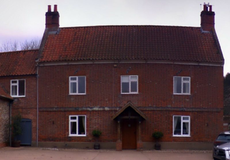

Norwich office
Survey Solutions
The Dairy Barn, St. Mary’s Court
Carleton Forehoe, Norwich
Norfolk
NR9 4AL
Directions
01603 757677

Click map for directions


