Tipples Farm
Published on by James Wyllie
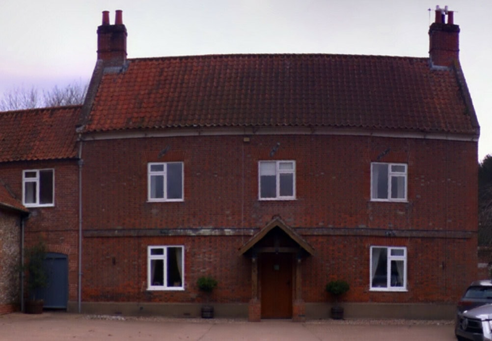
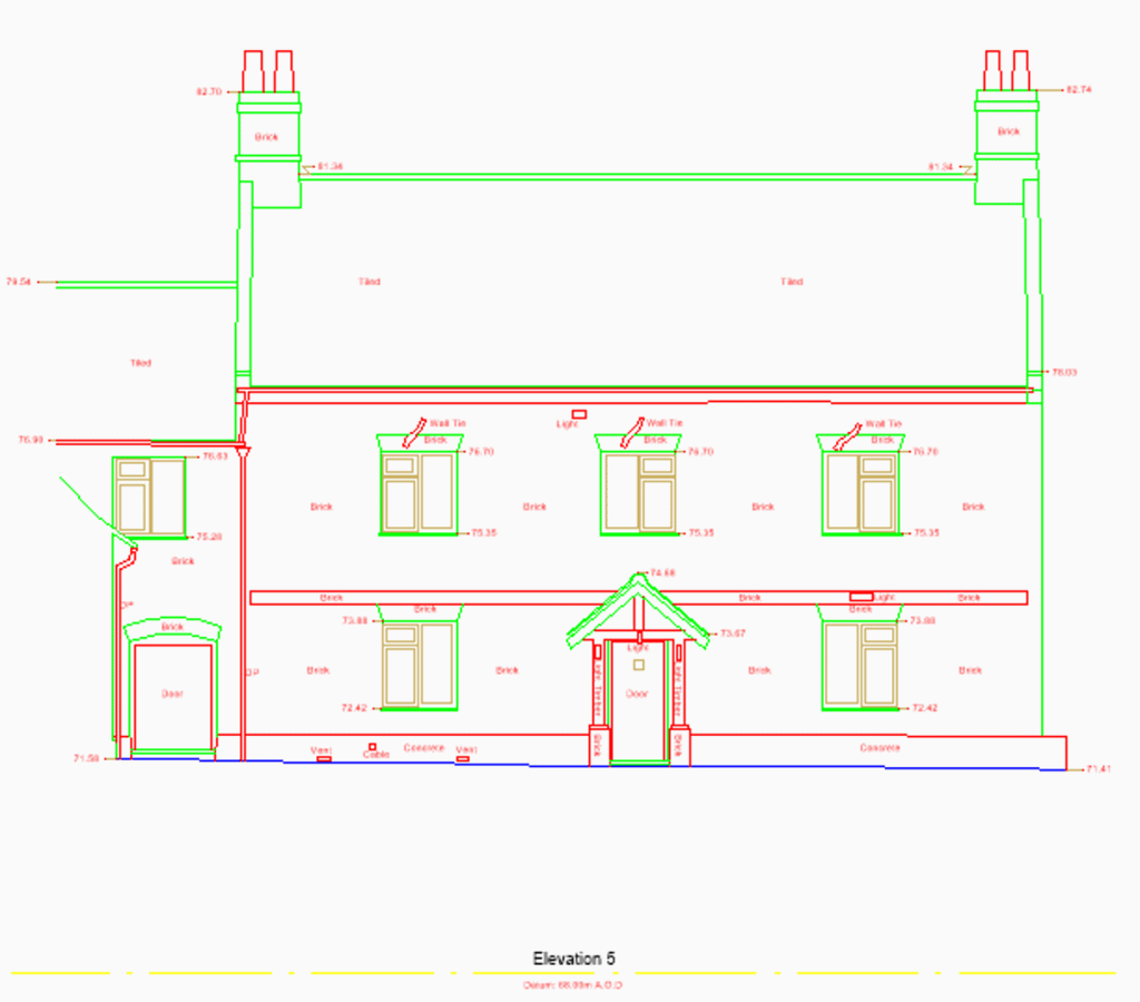
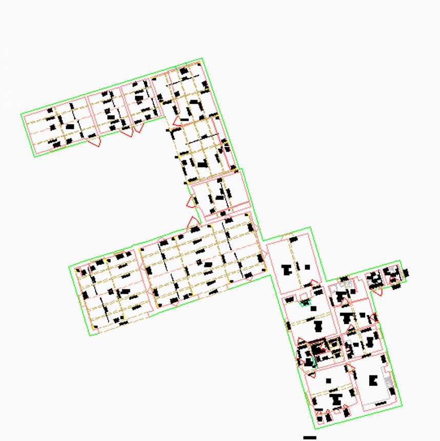
Survey Solutions were commissioned by G. W Harrold & Partners to undertake a comprehensive topographic and measured building survey at Tipples Farm, a mixed agricultural and residential site in Norfolk required to support repair works and to inform future planning. The site comprised a three-storey farmhouse, a two-storey semi-detached house and six agricultural buildings used for grain storage, plant storage and stabling.
Delivering Accurate Survey Data Across a Complex Rural Site
The measured building survey was required to provide detailed floor plans and elevations of all buildings, while the topographic survey captured the surrounding landform and features. The outputs would be used as the basis for design development and planning.
To ensure a consistent and accurate dataset, the topographic survey was undertaken first to establish the survey control. This data was used to globally register the 3D laser scan data captured during the measured building survey, ensuring all point cloud data was accurately referenced within the same coordinate system. By using common control across both surveys, positional accuracy was maintained between land and building data, providing a coordinated dataset.
Survey Challenges
Tipples Farm presented typical challenges of an active rural site, particularly as large farm machinery and delivery lorries were operating around the buildings. Our surveyors worked in co-ordination to ensure their safety, while minimising disruption to the activities on the farm.
Programme sequencing was also influenced by tenant requirements: the internal survey of the farmhouse was prioritised, followed by the semi-detached house and agricultural buildings.
Survey Solutions used 3D laser scanning technology to capture accurate, high-resolution geospatial data. To improve efficiency on a site with multiple structures, scan data was separated into individual point clouds for each building. This enabled multiple CAD teams to work in parallel and reduced overall processing time.
Project Outcome
The topographic and measured building surveys were completed on schedule, providing reliable datasets suitable for planning, design and assessment purposes.
The combined use of topographic and 3D laser scanning data delivered a coordinated dataset covering both external landform and detailed building geometry. The approach also future-proofed the data, allowing additional information to be extracted without additional visits to site.
This project demonstrates the delivery of exceptional technical expertise and ability to manage complex site operations. A coordinated approach ensured precise, dependable survey data was captured while minimising disruption on a busy working farm. Resulting in giving the client complete confidence in both the process and the final deliverables.