Agriculture
Surveys and Monitoring for the Agriculture Sector
Supporting rural estates, farms, and agri-businesses with accurate land insight and engineering certainty.
In a sector where land is both asset and livelihood, accurate geospatial data is essential. Whether you’re planning infrastructure upgrades, optimising drainage, constructing new buildings, or managing land boundaries, Survey Solutions delivers the insight needed to make confident, cost-effective decisions.
We support private estate owners, land agents, agri-businesses, and public sector land managers with a comprehensive range of survey and monitoring services tailored to the unique needs of the agricultural environment.
From new farm buildings to upgraded irrigation systems, agricultural development relies on accurate data to get the job done right. Whether you’re expanding operations, modernising facilities or improving environmental performance, trusted survey insights are essential.
Survey Solutions provides clear, actionable data to support the planning, design and maintenance of agricultural infrastructure across the UK.
Why Surveying Matters in Agriculture
Agricultural sites are complex and dynamic. From undulating topography and watercourses to access constraints and historic boundaries, rural land brings distinct challenges that require experienced survey input.
Our survey services help you:
- Plan new farm infrastructure, such as access roads, grain stores, silos, or renewable energy installations.
- Design effective drainage or irrigation systems, through detailed topographical and elevation mapping.
- Monitor structural movement in barns, reservoirs, or estate buildings with ongoing deformation and settlement analysis.
- Capture asset data for estate management, supporting long-term planning, valuations, and development control.
- Meet compliance and planning requirements, with surveys aligned to CDM regulations and local authority needs.
Survey Services Tailored for Agricultural Projects
Our teams deliver survey data that supports both traditional farming operations and future-ready agri-tech systems.
Topographical and Land Surveys
Full terrain mapping of farmland, tracks, watercourses, and built assets, using GPS, total station, and UAV where appropriate.
Underground Utility Surveys for Agricultural land
Identifying buried services and informing drainage design using GPR and other non-invasive methods.
For agricultural buildings, barns, and farmhouses—ideal for renovation, conversion, or valuation.
Structural Monitoring
Structural movement and settlement monitoring for large agricultural sheds, reservoirs, and rural infrastructure
Environmental Monitoring
- Assess and track land health, runoff or buffer zones
- Useful for grant applications, audits and sustainable practices
Hydrographic and Drainage Surveys
- Map open water, drainage ditches and flood risk areas
- Support land drainage schemes and environmental stewardship
Digital Twins and BIM Models
- Create accurate digital models for planning and asset management
- Useful for multi-building farms, anaerobic digesters or food processing sites
Volumetric Surveys
Track stockpile volumes, silage pits, or earthworks with reliable 3D models and reporting.
How do Surveys Support Agricultural Projects?
Survey Solutions supports clients across arable, livestock and mixed-use operations. Our data helps:
- Secure planning for new buildings and infrastructure
- Deliver compliant upgrades to existing sites
- Improve field and irrigation layout planning
- De-risk excavations and site work
- Maintain safety across agricultural buildings
Example projects include:
- Topographical and utility survey for a dairy unit upgrade
- Measured building survey for barn conversions
- Drainage mapping and flood risk survey for a rural estate
Surveys – Supporting Smarter Farm Management and Development
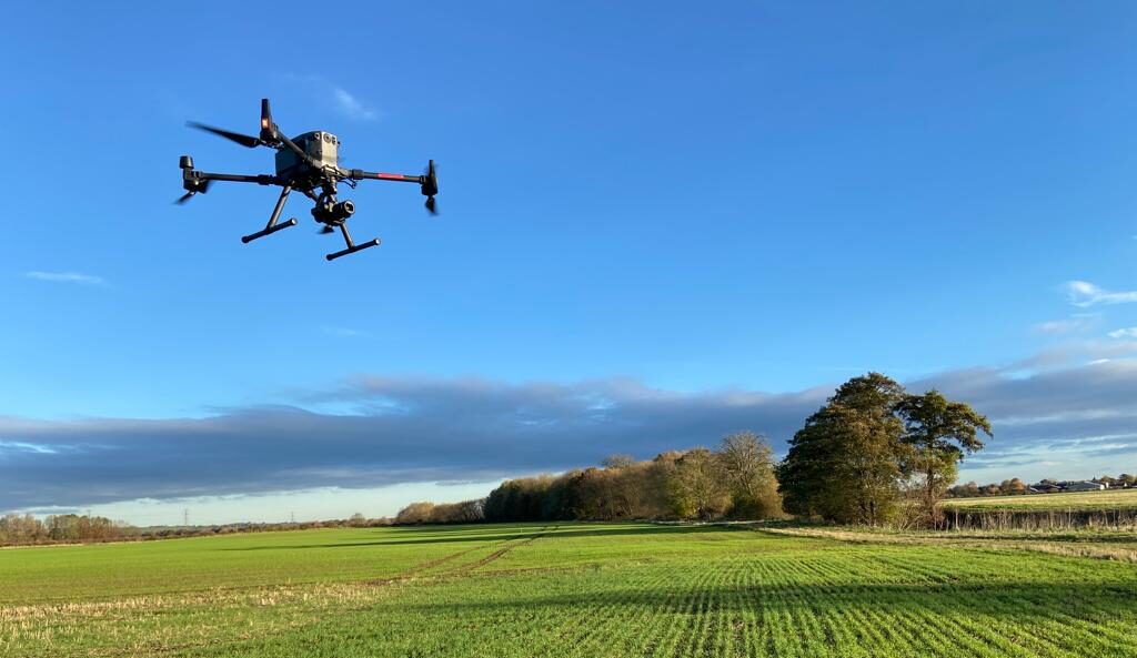
With nationwide coverage and local experience, we bring a flexible, responsive approach to working in agricultural settings. Our teams are equipped to access remote and rural sites, and we can deploy UAV (drone) and LiDAR technologies to reach areas that are otherwise inaccessible or sensitive.
We’re also experienced in coordinating with estate managers, landowners, and third-party contractors—ensuring minimal disruption to operations and livestock.
Speak to our team about your rural survey requirements. Whether you manage a 1,000-acre estate or a single development plot, we’ll help you move forward with confidence.
Make an Enquiry
"*" indicates required fields


