Hobhole Bank Hydrographic Survey
Published on by Natalie Taylor-Clarke
Survey Solutions delivered multi-service surveys at Hobhole Bank to support design of a new pumping station—combining land, building and tidal hydro data.
Our Nottingham team battled winter weather to carry out the Hobhole Bank Hydrographic survey alongside other services to assist with the design of the new pumping station.
Owned by Witham Fourth District Internal Drainage Board, the pumping station in Boston Lincolnshire opened in 1957. Its purpose is to protect the area’s low-lying land from flood risk by pumping flood water out to the tidal River Haven. To future-proof against Hobhole Bank’s eventually decommissioning, a prospective new pumping station is being designed.
Multi-Service Survey Aiding the Design of New Hobhole Bank Pumping Station
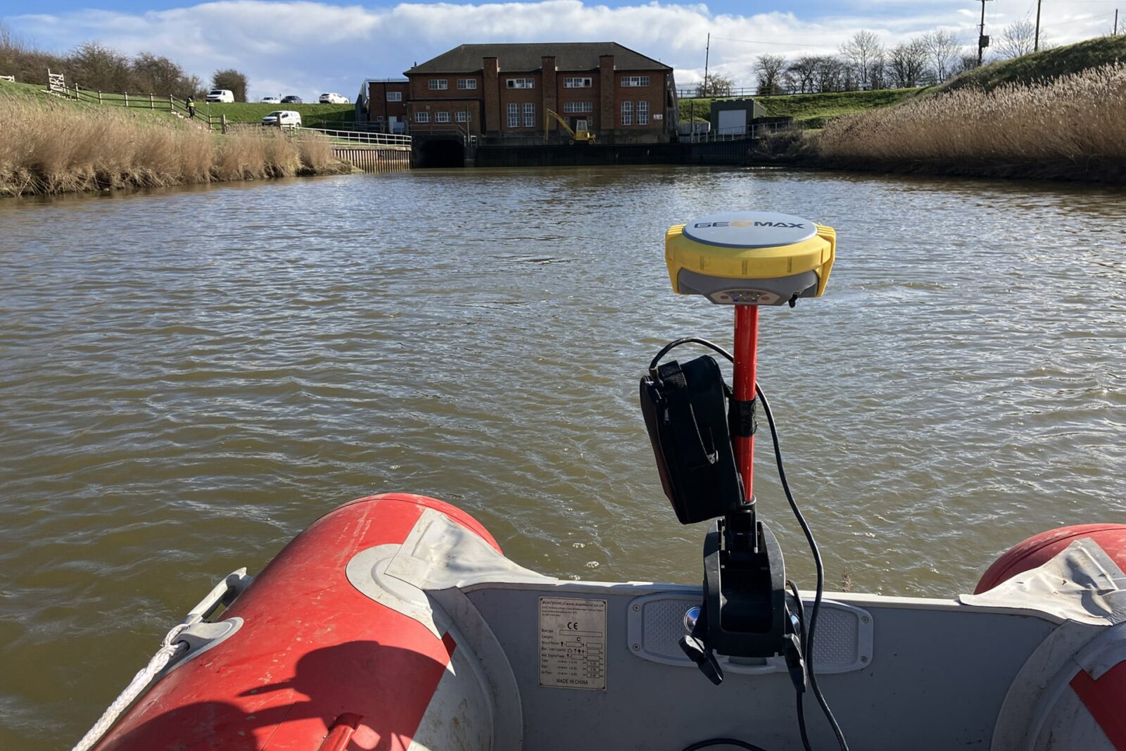
The Survey Solutions team carried out a complete a multi-service surveying project including land, measured building surveys and hydrographic surveys of the Pumping Station and surrounding area. The pumping station building itself presented its own challenges, and the area surrounding it required a uniquely planned approach. Measuring 600m2 along the coastal side of the river the area included 2km of tidal channel with mudbanks and steep, and often densely vegetated, channel sides and tidal pattern that needed to be assessed.
Total Solution Surveying
Whilst much of the land surrounding the pumping station could be measured by a traditional topographic survey approach using Total Stations and GPS instruments, the tidal mudbanks, which were inaccessible, required a slightly different approach. To measure these our team used the reflector-less capability of the Total Stations, which essentially involved taking measurement readings via laser remotely from the other side of the bank. This technology was also applied to measure the seaward side of the site when the tides were out and the mudbanks were exposed.
A hydrographic survey was required to measure the same end of the site where the channel flows from the station to the River Haven. By rowing a boat fitted with an echosounder across the channel our surveyors were able to capture the depths and profile of the channel’s bed.
To measure the concrete base at the screened inflow of the pumping station our team rowed out and extended a 5m pole down that could be pushed through the sediment to record the levels of the concrete below.
The data from all the surveys conducted over four days, including the internal measurements of the pumping station, was loaded into our modelling programme n4ce, to produce a single survey model. Once this was double checked for accuracy, the model was exported to CAD to provide the client with a 3D CAD model of the entire site.
Discover more about Survey Solutions’ hydrographic services.
“We’ve have been very satisfied with the services provided by Survey Solutions at Hobhole Bank. The surveying team were very professional, organised and competent, delivering quality output that we can use for the scheme design at a price that more than met with our expectations. I wouldn’t hesitate to recommend them.”
Principal Engineer, Stantec


