Supporting Asset Management Period 8 (AMP8) Regulations in the UK Water Industry with Accurate Surveying Data
Published on by Jonathan Simpson Tarling
The UK water industry is undergoing a new regulatory process with Asset Management Period 8 (AMP8) being introduced in April. Ofwat, the Environment Agency, and the Department for Environment, Food & Rural Affairs (DEFRA) are implementing stricter performance commitments to enhance water efficiency.
The UK water industry is undergoing a new regulatory process with Asset Management Period 8 (AMP8), introduced in April this year. Ofwat, the Environment Agency, and the Department for Environment, Food & Rural Affairs (DEFRA) are implementing a range of stricter performance commitments to further enhance water efficiency up and down the UK.
AMP8 is designed to drive improvements across several key areas including:
- Stricter targets for water loss and improved monitoring techniques before, during and after all projects.
- Enhancing asset management to prevent any failures and to ensure long-term sustainability for years to come.
- Strengthening commitments to reduce pollution, improve water quality throughout, and enhance natural ecosystems in the surrounding area.
- Improving service delivery, cost efficiency, and long-term infrastructure planning.
As all water companies across the UK prepare to meet requirements set by AMP8, investing in quality data is crucial for compliance going forward.
How do surveys support AMP8 targets?
A major focus in AMP8 is the reduction of water lost through multiple leaks.
Utilities surveys for advanced asset mapping
Underground utilities surveys can plot and identify locations and depths of the water network below, assisting engineers to locate leaks without having to break ground. At Survey Solutions we utilise non-invasive techniques to avoid any large groundworks costs by using Electromagnetic Location (EML) and Ground Penetrating Radar (GPR), helping companies meet their performance targets efficiently. Not only this, but hydrographic /bathymetric surveys can also be used to provide crucial information using wide array sonar to give you detailed plans of all the features below the water up to a depth of ten metres. This data can then be translated into a Digital Terrain Model, or commonly known as a DTM, which can then detail the contours of the land below the water.
Digital twins for asset management
Proactive asset management is extremely important within AMP8, with emphasis on precise geospatial data. Surveying with techniques such as LiDAR or Laser Scanners, GPS/ GNSS, and GIS mapping to create virtual models known as Digital Twins of water networks. At Survey Solutions, we collect 3D Point Cloud Data using static scanners, drone scanners and driven scanners (mobile mapping), to provide precise modelling which can result in more informed decision-making. We know that file size is also sometimes a factor when receiving these large scale point cloud files and at Survey Solutions we offer several solutions inhouse to be able to view, download and share all of this information without having to clog your own servers with large files. With the ability to annotate, view and edit your files, we want to make sure it is as easy as possible to interact with your data without the need for any costly licences.
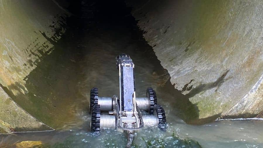
Improving network resilience with non-intrusive surveys
Within AMP8’s resilience goals, surveys must assess the condition of any aging pipelines, sewer assets and infrastructure without causing any service disruptions. CCTV drainage conditioning surveys, drone surveys with photogrammetry and 3D scanning can help with the planning of effective maintenance. Not only this, but a measured topographical survey can also compliment your site and any other additional work to map any embankments, boundaries or nearby buildings.
Cost-efficient planning and investment optimisation
With tighter budgets and greater accountability at play, AMP8 requires companies to make smarter, data-driven investment decisions. Quality survey data enables utility companies to prioritise infrastructure upgrades and reduce any potential operational risks. Accurate data minimises the risk of re-drawing survey plans with multiple drafts along with the associated re-design and added complications on site.
For more information, please email contactusweb@survey-solutions.co.uk or get in touch using the form below.
Make an Enquiry
"*" indicates required fields


