Survey and Monitoring Services for the Water Sector
Water infrastructure projects require accurate survey data. Whether the work involves upgrading a treatment works, replacing a pumping station, rehabilitating a sewer network, or assessing reservoir capacity. Decisions depend on knowing what’s actually on site above ground, below ground, and underwater.
Poor or incomplete survey data causes problems downstream: design clashes, utility strikes, programme delays, and rework. On operational sites where records may be decades old or missing entirely, assumptions are risky. This page covers the survey and monitoring services applicable to water sector projects, including utility detection, topographical surveys, measured building surveys, CCTV drainage surveys, bathymetric surveys, and structural monitoring.
Utility Detection and Mapping
Accurate utility records are often unavailable on water sector sites. Treatment works and pumping stations may have been modified repeatedly over decades, with incomplete or contradictory documentation. Utility strikes during excavation cause project delays, cost money, and create safety risks.
PAS 128 utility detection uses electromagnetic location and ground penetrating radar to detect and map buried services. This includes water mains, power cables, gas, telecoms, drainage, and redundant or abandoned services that may not appear on any drawing.
Survey data includes horizontal position, depth, and a quality level classification indicating confidence in each detected service. Deliverables are provided in CAD formats, geo-referenced and coordinated with topographic data where required.
Applications: Pre-construction surveys for treatment works upgrades, pipeline diversion planning, pumping station replacement schemes, CSO improvement works, mains replacement programmes, ground investigation planning
Topographical Surveys
Site design and construction planning require accurate information about existing ground levels, surface features, structures, and boundaries. Topographical surveys capture this data for use in feasibility studies, detailed design, earthworks calculations, and setting out.
Water sector sites range from compact pumping stations to large treatment works complexes and reservoir compounds. Survey scope is tailored accordingly – from a single site survey to corridor surveys for pipeline routes.
Deliverables include 2D CAD drawings, 3D surface models, or integrated datasets combining above and below ground information.
Applications: Treatment works site surveys, pumping station surveys, reservoir and dam compound surveys, pipeline route surveys, flood storage scheme design, WINEP scheme feasibility and design
Measured Building Surveys
Refurbishment and upgrade projects on existing water infrastructure require accurate as-built information. Original drawings may be missing, out of date, or insufficiently detailed for modern design requirements.
Measured building surveys capture internal and external geometry including floor plans, elevations, sections, ceiling heights, structural elements, and M&E routes. This supports clash-free design for new plant installations and building modifications.
Deliverables include 2D floor plans and elevations, 3D models, and point cloud data. Revit models and IFC files are available for BIM workflows.
Applications: Treatment works building surveys, pumping station internal surveys, control room and MCC building surveys, plant room surveys for MEICA design, asset record updates
3D Laser Scanning
Complex process areas, dense pipework, and confined spaces are difficult to survey accurately using traditional methods. Laser scanning captures millions of measured points to create a detailed 3D record of existing conditions.
Point cloud data supports design coordination, clash detection, and visualisation. It can be used directly in design software or processed into 3D models and 2D drawings.
Scanning is particularly useful where speed matters, where access is limited, or where the complexity of existing infrastructure makes manual measurement impractical.
Applications: Process area surveys at treatment works, complex pipework and valve arrangements, filter and tank structures, intake and outfall structures, asset condition recording
CCTV Drainage Surveys
Drainage and sewer rehabilitation projects require accurate condition assessment. CCTV surveys allow for detailed internal examination of pipes and drains without the need for digging or dismantling structures. High resolution cameras to capture clear images and videos of blockages, displacements, root intrusions to help engineers identify the cause and location of any problems.
Surveys are carried out using crawler units for larger diameter pipes, push-rod cameras for smaller connections, and pan-tilt-zoom systems. Equipment selection depends on pipe diameter, access constraints, and survey objectives.
Defects are coded to MSCC5 standards. Reports are produced using WinCan software and include video footage, defect logs, structural condition grades, and repair recommendations formatted for integration with asset management systems.
Applications: Sewer rehabilitation planning, pre-construction drainage surveys, CSO and overflow investigations, network connectivity mapping, adoption surveys (S102/S104), treatment works drainage investigations, condition assessment for capital planning
Confined Space Entry
Some water sector survey work involves locations that present access challenges – deep sewers, wet wells, dry wells, valve chambers, and underground tanks. These are permit-required confined spaces with specific safety requirements.
Survey teams trained and equipped for confined space entry can carry out work in these locations with their own gas monitoring, breathing apparatus, rescue equipment, and trained attendants. This avoids the need to arrange separate confined space cover, which can add cost and delay.
Applications: Deep sewer surveys, wet well and dry well surveys, valve chamber inspections, underground tank surveys, culvert surveys
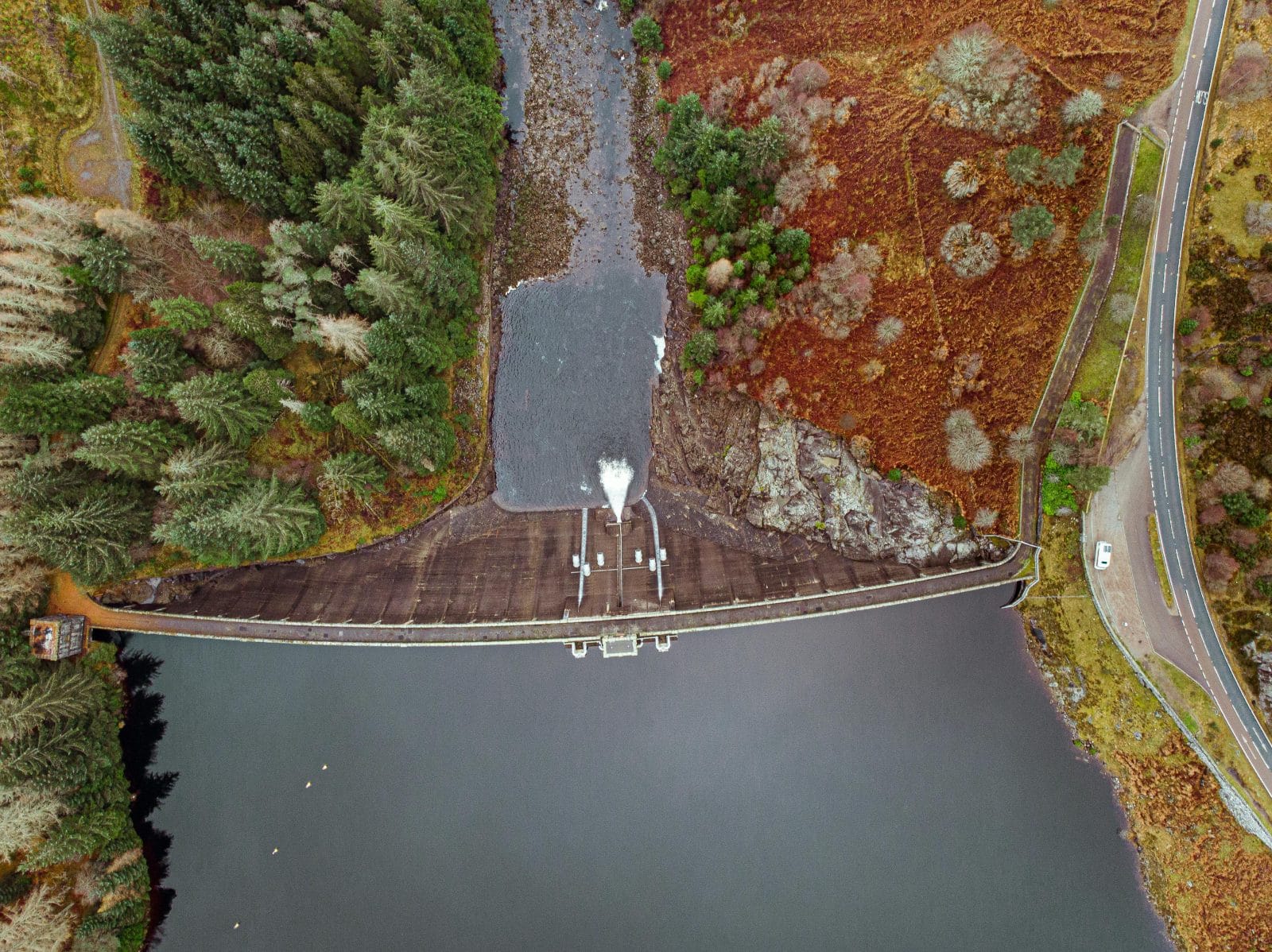
Bathymetric and Hydrographic Surveys
Reservoir management, dam safety, and flood scheme design require information about what’s below the water surface. Silt accumulation reduces reservoir capacity. Bed levels affect flood storage calculations. Underwater structures require inspection.
Bathymetric surveys map bed levels and underwater topography using sonar equipment mounted on remote-controlled survey vessels. This approach is safer than putting people in the water and provides better coverage.
Surveys can be integrated with above-water topographical surveys, with embankments, spillways, and surrounding infrastructure tied to the same control network.
Applications: Reservoir capacity assessments, silt accumulation surveys, dam face inspection support, river channel surveys for flood modelling, spillway and outfall surveys, abstraction point surveys
Structural and Ground Monitoring
Some water infrastructure assets require ongoing observation – dam embankments, flood defences, pipelines, or structures adjacent to construction activity. Monitoring tracks movement over time and provides early warning of potential problems.
Monitoring points are installed and measured to sub-millimetre accuracy using precise levelling and total station techniques. For assets requiring continuous observation, automated systems provide real-time alerts when movement exceeds defined thresholds.
Monitoring programmes can run for months or years, with regular reporting and maintenance of monitoring infrastructure throughout.
Applications: Dam and reservoir embankment monitoring, flood defence monitoring, pipeline settlement monitoring, construction impact monitoring, long-term asset condition monitoring
Why choose Survey Solutions for Water Sector Projects?
Capacity to deliver at scale – Operations from 13 locations across England, Scotland and Wales. Local teams can mobilise quickly to sites across the country, supporting water companies and framework contractors with geographically dispersed assets. Over 200 surveying professionals. Capacity to support framework-scale programmes requiring multiple concurrent survey packages, as well as individual site surveys.
All disciplines in-house – Topographical, utilities, measured building, monitoring and hydrographic services all under one roof, for one relationship and consistent quality.
Water sector experience – We’ve worked on treatment works, pumping stations, reservoirs, pipelines, and network assets across multiple water company regions. We understand the operational constraints and regulatory context.
Accreditations
- ISO 14001:2015
- ISO 9001:2015 (Quality Management)
- ISO 27001:2017 (Information Security)
- ISO 45001:2018 (Occupational Health and Safety)
- Cyber Essentials Plus
- CICES affiliated
Utility surveys delivered to PAS 128 standards. Surveyors hold relevant water hygiene and safety certifications for operational water industry sites.
Trusted by the leading consultants, contractors and asset owners in the UK
We’re trusted by a number of experienced water companies, contractors, and design consultants including: Kier, Galliford Try, M Group, Mott MacDonald, Strabag, Arup, Jacobs, AECOM, Stantec, Southern Water, Wessex Water, Severn Trent, United Utilities, Thames Water


