West Midlands Reservoir Survey
Published on by Toni Abrahams
Survey Solutions was appointed to conduct repeat reservoir surveys across the West Midlands and Staffordshire as part of an ongoing monitoring framework for client Breheny on behalf of the Environmental Agency.
The programme supports the Environmental Agency duty as reservoir owner to undertake regular monitoring in line with the Reservoirs Act 1975. This programme covers eleven reservoir sites; each visited annually under a planned schedule of works.
Why the Survey Was Required
Monitoring dams and reservoirs is essential to ensure they stay safe and perform as intended. Measuring crest levels, pins, nails, ground, and water levels can detect changes over time. Crest settlement or deformation can show potential issues within a dam and may require further investigation.
A key focus of the survey is the crest, the highest point of the embankment. Crest level measurements help assess flood risk and support water flow modelling. By comparing current and historic data, the Environment Agency can identify trends and respond to early signs of movement.
Scope of Services
The programme covers eleven reservoirs across the West Midlands and Staffordshire, whereby each site has specific monitoring requirements. Annual repeat surveys are conducted across the sites in line with the Environment Agency’s monitoring requirements.
The scope included digital levelling of monitoring pins, nails, and crest points; water level monitoring at outlet structures, inlet weirs, lakes, and other specified locations; inspection and maintenance of monitoring points; cleaning, clearing and repainting covers; and lubricating monitoring well lid hinges where needed.
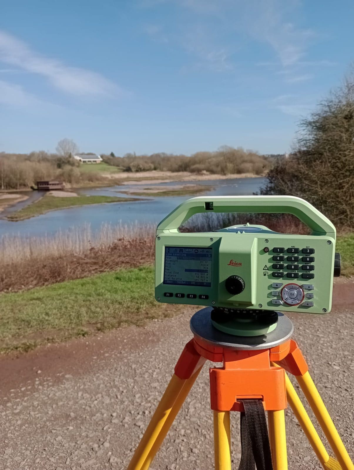
To collect the data, the survey team used a Leica LS10 digital level to measure monitoring point heights with sub-millimetre accuracy. An Invar barcode staff enabled the instrument to read measurements digitally rather than relying on manual visual readings, improving consistency and reducing human error.
A Trimble R12i GPS was used to measure crest and water levels, supporting accurate and repeatable monitoring across each site.

Challenges
One of the main challenges was finding and accessing monitoring wells, since many of these are found underground. Over time, these can become overgrown or filled with mud and gravel, which is why our Survey team have the challenge to find, uncover, clear and maintain them before accurate measurements can be taken.
Each site also presents different physical conditions, access constraints and monitoring layouts. While the overall process is consistent, the work demands patience, precision and a clear understanding of each reservoir’s requirements.
Our Approach
The project was delivered by a two-person team that consulted with the Contract Supervisor on access, programme requirements and any issues or early warnings that may affect delivery.
This initial project developed into an on-going monitoring programme as we support the long-term maintenance of the monitoring network. This includes finding damaged points, digging out buried wells, clearing debris, spraying covers and keeping points usable for future surveys. This continuity is important because repeat monitoring depends on consistent method, accurate point identification and comparable year-on-year data.
Outcome
Through sub-millimetre digital levelling, repeatable annual data, clear comparison with historic results, movement trend graphs, concise method reports, photographic records and proactive maintenance of monitoring points, Survey Solutions supports the Environment Agency in monitoring the safety and performance of reservoir assets across the West Midlands and Staffordshire
Since the framework is ongoing, the client receives consistent, comparable data over time, helping to identify early signs of settlement, deformation or structural movement and supporting informed decisions on reservoir safety, flood risk and long-term asset management.