Confined Space Laser Scanning Maps Deep Sewer to Unlock Residential Development
Published on by Toni Abrahams

Survey Solutions was appointed to accurately find the position of a deep combined sewer running beneath a proposed residential development site.
The client was planning a five-storey apartment block and needed certainty that the building footprint would remain outside the statutory easement protecting the sewer.
An earlier utilities survey found the sewer using statutory records. It was estimated to be around eight metres deep, which meant it could not be detected using conventional underground utility survey methods. A later CCTV drainage survey also proved unable to provide the positional accuracy needed due to the depth of the asset.
Without reliable survey data, uncertainty remained over whether the proposed development would encroach on the sewer easement, creating potential design risk, programme delays and added costs.
The Challenge
The sewer’s depth was the main challenge. At around eight metres below ground level, it was beyond the practical range of standard utility locating techniques and could not be accurately surveyed using CCTV equipment alone.
The client needed engineering-grade positional data, rather than estimated record information. This enabled the design team to confidently show the available development envelope.
Alternative methods were considered, including the deployment of a caged drone within the sewer. With only approximately 300mm clearance between the water level and the soffit of the sewer, combined with the likelihood of interference from surrounding buried utilities beneath the pavement, the risk of losing the drone outweighed any potential benefits.
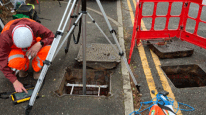
Confined Space Laser Scanning Survey to Map Deep Sewer
Our Approach
Survey Solutions proposed an innovative alternative using its confined space surveying capability.
Working within the confined space environment, the team deployed a laser scanner inverted into the manhole to capture the internal geometry of the sewer. This approach enabled the precise alignment and mapping of the underground asset, providing an exact representation of its position beneath the site.
By combining specialist confined space ability with high-accuracy laser scanning technology, the team was able to generate reliable survey data where conventional techniques had been unable to deliver the required level of confidence.
The Outcome
When existing records and conventional survey techniques could not accurately find a deep combined sewer, we developed an alternative approach using confined space laser scanning. The result provided the client with the confidence to progress a proposed five-storey residential development while protecting a critical underground asset.
The survey accurately showed the alignment of the combined sewer, giving the client the engineering certainty needed to continue the design process.
The results confirmed that the sewer occupied slightly less of the development site than initially expected from statutory records, providing added flexibility within the proposed building footprint while ensuring the required easement could still be kept.
By replacing estimated record information with measured survey data, Survey Solutions helped remove uncertainty from the project, reducing design risk and supporting informed decision-making before construction began.
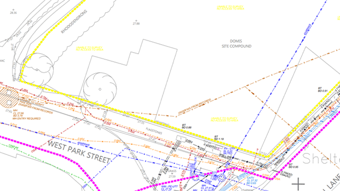
Survey Deliverable
Why It Matters
Deep underground assets can present significant challenges for development projects, particularly when existing records are incomplete or conventional survey methods cannot verify their position.
By combining specialist confined space capabilities with advanced laser scanning technology, Survey Solutions were able to accurately map hard-to-access underground infrastructure. This provided developers, engineers and designers with the reliable data they need to progress projects with confidence.