Mobile Mapping
What is Mobile Mapping?
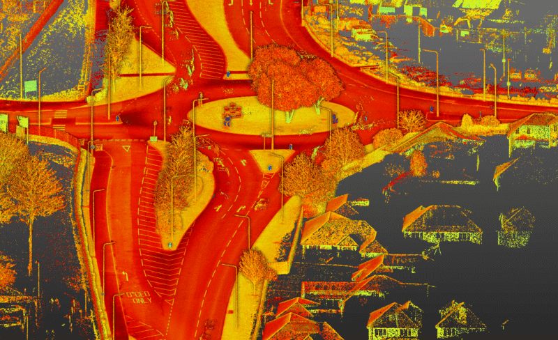
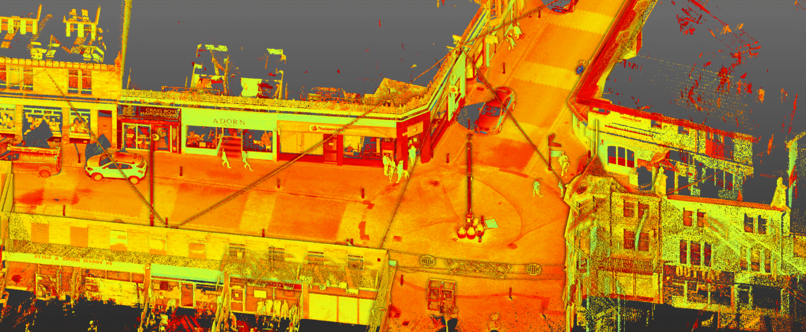
For projects where a vast amount of detailed Geo-Spatial data needs to be collected quickly over a long distance, Mobile mapping is often an ideal solution. This method is particularly suitable for road, highway, and infrastructure projects.
Mobile mapping is the the use of a mobile vehicle equipped with a 3D laser scanner, capable of capturing thousands of data points per second and can cover up to 20km in one day.
Each survey can provide various data formats and survey information, ranging from basic 2D site layouts and plans to more detailed outputs, including point clouds and fly-through animations. Additionally, we can use this data to create Revit models, and our experienced team will be happy to advise where needed.
How is the data collected?
Mobile mapping typically require two surveyors on site. Initially, all equipment is checked and activated in areas with optimal maximum GPS coverage and the route is driven at normal traffic speeds to create a survey route plan.
They begin with continuous monitoring of positional quality to ensure high accuracy. The data collected includes laser information and imagery, and to achieve the best accuracy, ground control points (GCPs) are installed at regular intervals within the survey area. The coordinates of these points enhance the precision of the point cloud during processing.
When the survey is completed, the Geo-Spatial data is processed to generate the most accurate trajectory possible and to facilitate the creation of the point cloud aligned with the GCPs. The point cloud is then cleaned and colorized, ready to be utilised for your project’s requirements.