Land and Utility Surveyors in London Central
Survey Solutions’ London Central office supports projects across central London and the wider capital, providing accurate survey data for complex, constrained and high-value sites. Our local team works with architects, engineers, contractors, developers, estates teams and public-sector clients on land surveys, measured building surveys, underground utility surveys, drone surveys, monitoring and site engineering support. From heritage buildings and museums to healthcare, commercial, residential and infrastructure projects, we help project teams make confident decisions in demanding urban environments.
Survey services from our London Central office
Our London Central office provides a full range of survey services for projects across the capital. These include topographical surveys, measured building surveys, underground utility surveys, laser scanning, UAV/drone surveys, monitoring and site engineering. London sites often involve access constraints, live operations, neighbouring structures, basement levels, heritage considerations and multiple stakeholders, so each survey is planned carefully around the project’s technical and logistical requirements.
Topographical surveys for central London sites
Topographical surveys provide accurate information about existing site levels, boundaries, street features, drainage, structures, access routes, hardstanding and surrounding detail. In central London, this information is essential for design teams working on constrained plots, public realm, transport-adjacent sites, redevelopment schemes, commercial properties and mixed-use developments. Our London Central surveyors help provide the reliable base data needed for planning, design coordination and construction preparation.
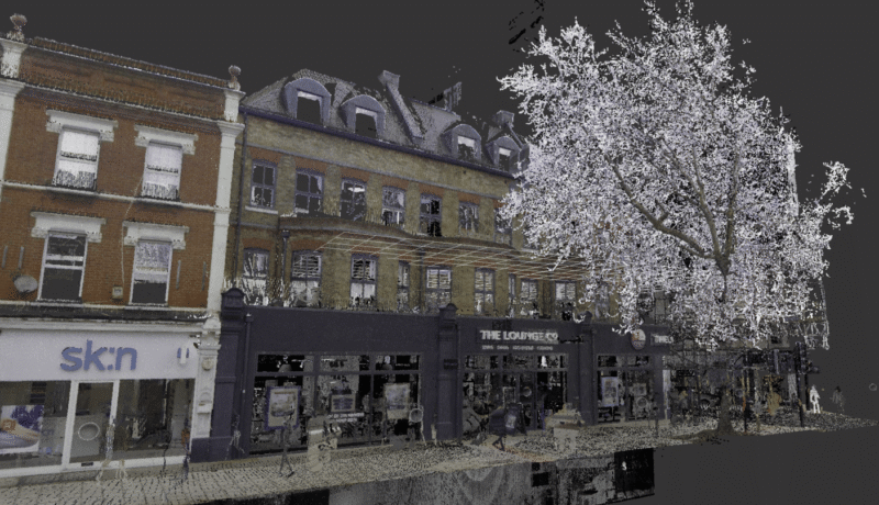
Measured building surveys for heritage, commercial and residential assets
Existing buildings in central London often have complex layouts, historic fabric, multiple alterations and limited original information. Our measured building surveys can provide floor plans, elevations, sections, roof plans, point-cloud data and 3D outputs to support refurbishment, redevelopment, conservation, fit-out and asset management. Accurate measured information helps architects, engineers, contractors and asset owners reduce assumptions before design work begins.
Underground utility surveys for dense urban environments
Central London sites can contain complex below-ground infrastructure, including drainage, telecoms, electricity, water, gas and other buried services. Our London Central office can provide underground utility surveys to help project teams understand below-ground constraints before design, excavation or construction. Where required, survey scopes can be aligned with PAS 128 to support clearer risk management and coordination.
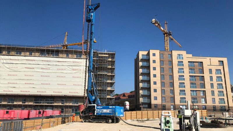
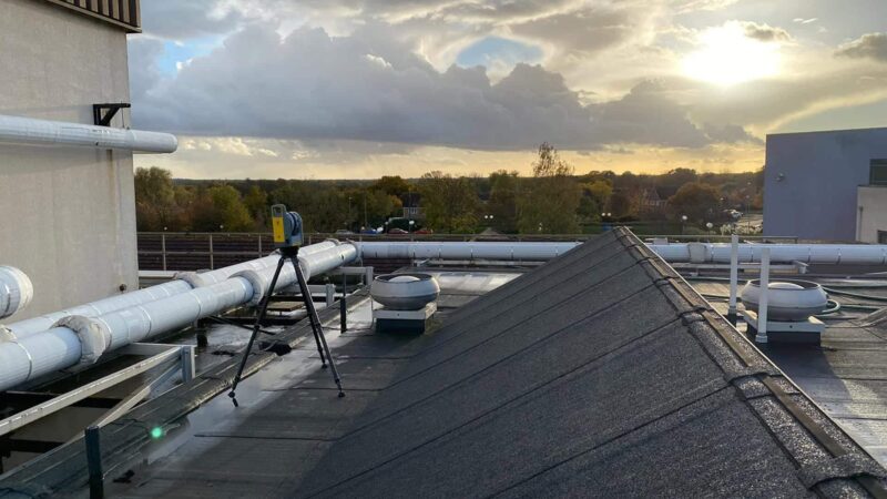
Monitoring, laser scanning and construction-stage support
Where projects require ongoing observation or detailed 3D information, our London Central team can support monitoring, laser scanning and site engineering services. Monitoring can help track movement or change on sensitive sites, laser scanning can capture complex spaces efficiently, and site engineering can support construction-stage requirements. These services are especially valuable on constrained, live or technically complex London projects.
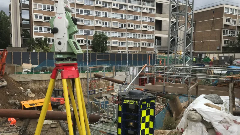
Surveying complex, constrained and high-value London sites
London projects often demand a higher level of survey planning due to access restrictions, adjacent properties, traffic, security, working hours, heritage considerations and live building operations. Our London Central team can help clients plan survey work around these constraints while ensuring that the information captured is accurate and useful. The aim is to reduce uncertainty for project teams operating in one of the UK’s most complex built environments.
Supporting heritage, healthcare, commercial and infrastructure projects
Different London sectors require different survey approaches. Heritage sites may need detailed measured building information and careful access planning. Healthcare and public-sector buildings often require coordination with live operations. Commercial and residential developments may need a combination of land, building, utility and monitoring data. Infrastructure and public-realm projects often require accurate topographical and underground utility information. Our team can tailor the scope to the needs of each site.
How do we manage access, safety and programme constraints in central London?
Before attending site, our team reviews the survey scope, access requirements, induction needs, working hours, hazards, deliverables and programme deadlines. We can coordinate with site managers, facilities teams, consultants and contractors to agree a practical method of working. This helps reduce disruption while ensuring the required information is captured safely and efficiently.
What deliverables can our London Central team provide?
Depending on the project requirements, deliverables can include 2D CAD drawings, 3D models, point clouds, measured building outputs, underground utility drawings, monitoring reports, site engineering data and other agreed formats. We will confirm levels of detail, coordinate requirements, file formats and issue dates at the start so the data can be used effectively by architects, engineers and contractors.
Speak to our London Central survey team
Contact the London Central office if you need survey support for a project in central London or the wider capital. Send us your site address, access information, scope or tender pack and we will advise on the most suitable survey approach.
Talk to us…
Get through to one of our specialists to help you with your project.
Felix Alexander
Structural and Environmental Monitoring
Recent Projects from the London Central Survey Team

London Central office
Survey Solutions
16 High Holborn
London
WC1V 6BX
Directions
0203 941 6876

Click map for directions


