Drone Survey to Support Structural Assessment of the Carmyle Viaduct
Published on by Natalie Taylor-Clarke
Drone survey Carmyle Viaduct: Survey Solutions supported Amey Consulting with a high-resolution drone inspection of the Carmyle Viaduct in Glasgow, delivering a 3D digital twin to enable safe, desk-based structural assessment.
Drone Survey Carmyle Viaduct – Supporting Structural Assessment for Amey Consulting
Survey Solutions was commissioned by Amey Consulting to support a structural engineering assessment of the Carmyle Viaduct in Glasgow. The brief was clear. Provide accurate, recent condition data to help engineers evaluate the viaduct’s strength and safety for future use.
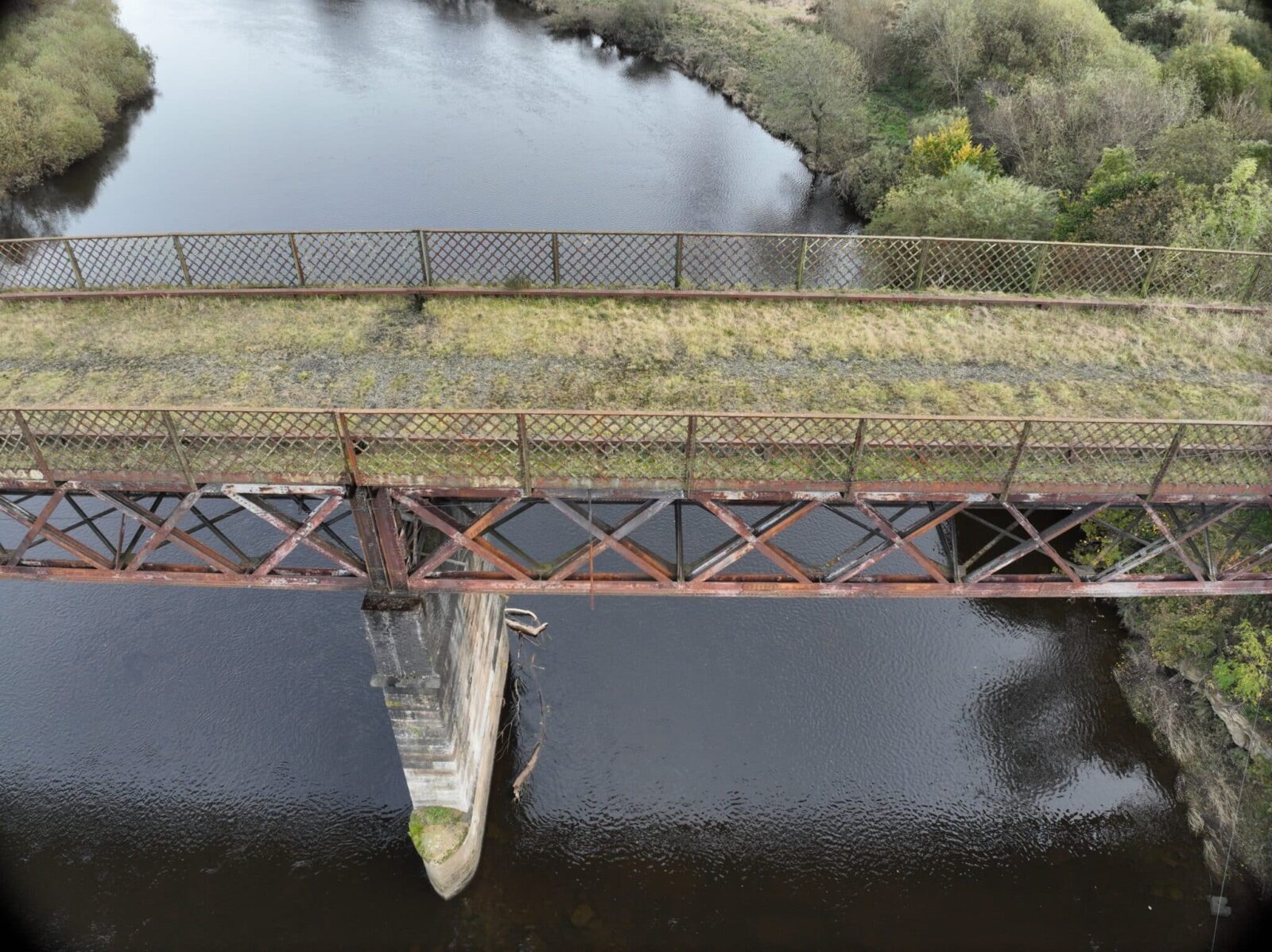
Access was the first problem to solve. The structure is high, long, and spans the River Clyde. Traditional inspection from boats or scaffolding would have added risk, cost, and time. Drone survey was selected to capture the evidence safely from the river embankments and adjacent land, keeping people out of harm’s way and minimising disruption.
CAA qualified pilots planned and executed the flight operations after a detailed risk assessment. Working within a controlled airspace plan, the team captured overlapping high-resolution video and still imagery across the full 140-metre length, including elevations, soffits where visible, and approach spans. Ground control points and known references improved positional accuracy. From these datasets, Survey Solutions produced a dense point cloud, orthomosaic imagery, and a registered photo set for close visual review.
The outputs were used to generate a 3D digital twin of the viaduct. This model allowed Amey’s engineers to carry out a desktop inspection at scale, moving through the structure virtually to review masonry, joints, parapets, and visible bearings. Annotated image sets supported defect logging and measurement of features of interest. All data was delivered in formats compatible with Amey’s existing software, so the engineering team could integrate results into their assessment workflow without delay.
The result was a clear view of current condition and areas requiring closer attention. The drone survey shortened programme time, reduced risk, and gave the project team a defensible record for future comparison. The data now informs decisions on maintenance and future use, while creating a baseline for ongoing monitoring.


