Mobile Mapping Levenmouth
Published on by Natalie Taylor-Clarke
Mobile mapping survey supports 35km Levenmouth Connectivity Project. Fast, safe data capture across urban, rural and high-traffic areas for active travel design.
Mobile Mapping Levenmounth Connectivity Project to gather data for this flagship project. We were asked to complete a 3D topographical survey of approximately 35km of rural and urban roadways and greenspace within the area as part of its design planning process.
35km Land Survey for Levenmouth Project
The Levenmouth Connectivity Project aims to reconnect the communities of Leven, Methil, Methilhill, Buckhaven, Windygates and East Wemyss and the River Leven through the creation of a safe and attractive active travel network for walkers and cyclers.
Safety and Accuracy with Mobile Mapping
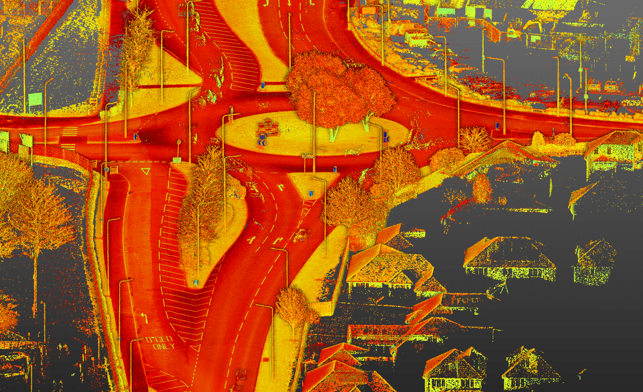
The area to be surveyed included busy dual carriageways, built up town and village centres, private farmland, residential streets and housing estates. Our job was to complete the survey with minimum disruption to the local road network and residents. The safety of our surveyors was also of paramount importance and strict health and safety policies needed to be adhered to.
The health and safety restrictions meant that traditional surveying methods involving a surveyor holding a total station were not suitable as that would have required our surveyors to work close to and within active roads and dual carriageways. It would also have taken a significant amount of time.
Our solution was to complete the majority of the survey using mobile mapping. With mobile mapping, geo-spatial data is collected by a 3D laser scanner mounted on car. It is the ideal solution to effectively, efficiently and safely capture a large amount of data and it meant we could complete 90% of the survey in just two days. The remainder of the survey was completed using traditional surveying methods.
Whist coordinating and integrating the two surveying methods and data was not without its challenges, the project was completed successfully with the provision of 3D and 2D auto cad drawings required by the client for design and planning purposes.


