Levenmouth Connectivity Project
Published on by Natalie Taylor-Clarke
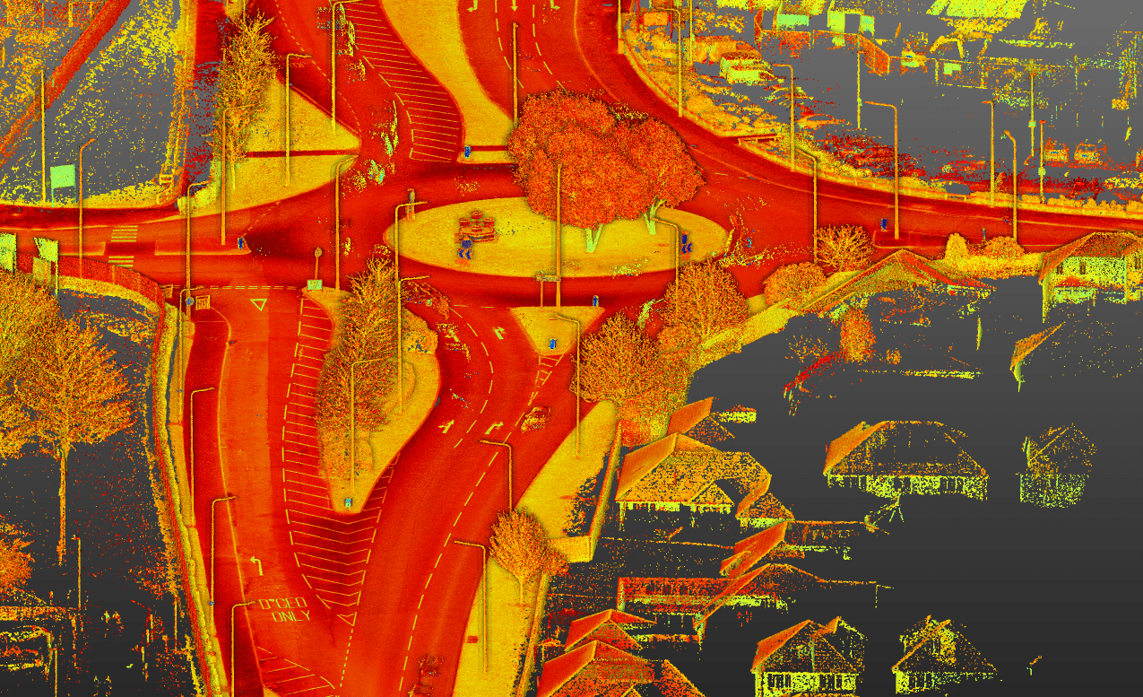
Mobile mapping and traditional survey techniques were used to support active travel infrastructure as part of the Levenmouth Connectivity Project.
Unlocking Active Travel in Levenmouth
As part of the Levenmouth Connectivity Project, our Glasgow team recently delivered 35km of detailed road survey across Fife—combining traditional techniques with mobile mapping in Levenmouth to support safer, greener transport links.
This ambitious regeneration programme aims to improve walking and cycling infrastructure across the region, aligning with the reopening of the Leven rail link and a wider vision for active travel along the River Leven.
Our survey data played a key role in informing route design and identifying constraints early—helping to reduce risk and accelerate progress across multiple towns and villages.
You can read the full case study here.


